The Bodleian purchased the map from Blackwell’s Booksellers in February for a price in the region of £60,000. A three-month fundraising campaign and financial support from the Victoria & Albert Purchase Grant Fund and the Friends of the Bodleian made the purchase possible.
The map was rediscovered last year among the pages of a copy or Lord of the Rings that had belonged to its illustrator Pauline Baynes (1922-2008).
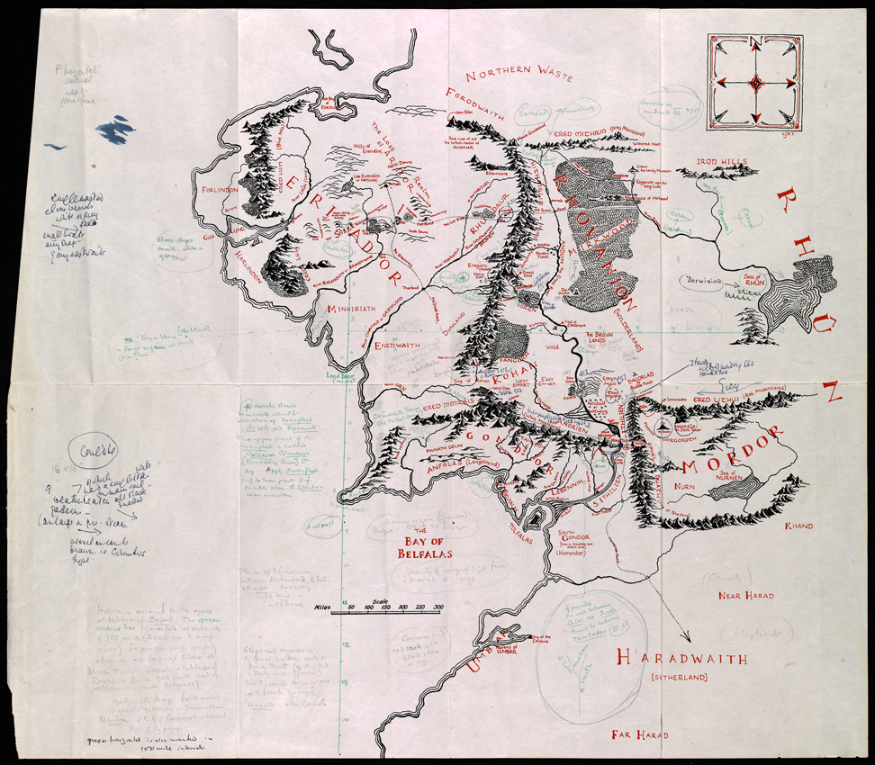
Baynes and Tolkien collaborated in 1969 on the creation of a poster map of Middle-earth. The piece now at the Bodleian shows the author’s detailed instructions for place names, inhabitants and terrain.
Naturally the presence of Tolkien’s hand lifts the value on his books and manuscripts. At a Sotheby’s auction in June 2015 a copy of The Hobbit inscribed with four lines of Elvish was estimated at £50,000-70,000 and was sold for £137,000 including buyer’s premium.
The map went on display in Oxford, Tolkien’s home for much of his life, at Blackwell’s Rare Books in October 2015.
Tolkien notes on the map that ‘Hobbiton is assumed to be approx. at latitude of Oxford.’
The map used for annotation was drawn by Tolkien’s son Christopher in 1954 and was included in the back of the first two volumes of The Lord of the Rings.
It has joined the Bodleian’s collection of Tolkien material which they have housed since 1979. Although are eventual plans to put the map on public display, it is currently available for Tolkien scholars to view only by request.