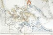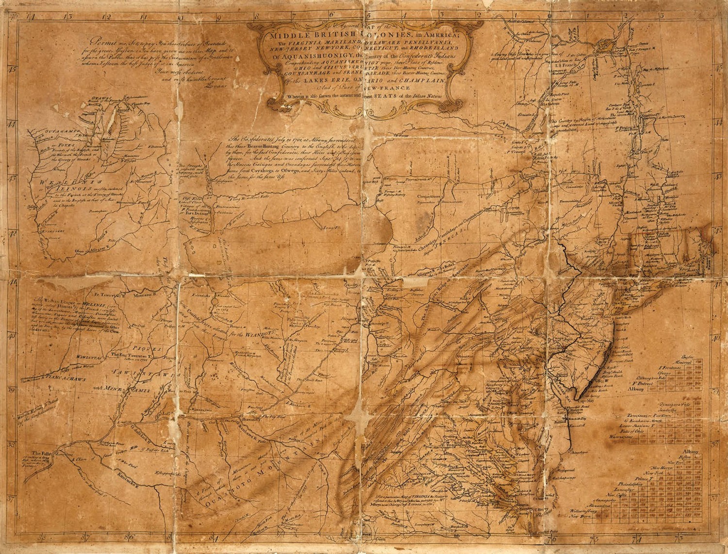
Drawn up by the Welsh surveyor Lewis Evans, A General Map of the Middle British Colonies in America published in 1755, set the standard for mapmaking in this region for half a century. Vast tracts of land were covered including, for the first time, those beyond the British frontier into the Ohio territory.
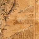
This copy, folded and backed on later linen, appears to be a working proof. While the general cartography is laid down, many of the finished elements are lacking - including Evans’ own engraved name and the name of the engraver, Benjamin Turner.
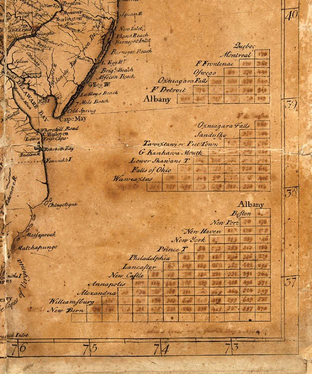
Some major place names are missing (a few of them added in manuscript to be later engraved) while the numbers in the distance tables are also added by hand. Below the tables (that correctly correspond to the engraved version) is an ink signature: ‘Lewis Evans ... May 2, 1755’.
“This is the maker of an 18th century American map literally signing off on the work-in-progress printing of his map which would go on to have historic implications 53 days before it was to be a finished product and ready to be officially published June 23rd, 1755,” said Swann Galleries’ specialist Caleb Kiffer. “Rarely, if ever, has a piece of an 18th century map’s publication story been preserved or offered for sale.”