Issued in small numbers in 1833 and again in 1835, it had a profound impact at a time when cartographic publishing in the Muslim world was largely stif led by Ottoman proscriptions on printing.
‘Christian knowledge’
The Church Missionary Society chose Catholic Malta, a Crown Colony, as the perfect place to begin its efforts to evangelise the peoples of North Africa and the Middle East. ‘Propagat ing Christ ian knowledge’ was part of the strategy.
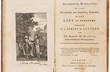
A pioneering press published books in Arabic from 1827-40, headed by local printer Matthäus Weiss, German linguist Christoph Friedrich Schlienz (and members of the Brocktorff family working as lithographers and binders). Frederico Brocktorff provided the illustrations to Ay majmu’ kharitat rasm al-ard…
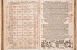
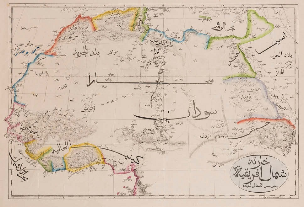
The title is purely descriptive: Drawings of the earth comprising the Eastern half of the globe, the Western half of the globe, Europe, Asia, Australia, Africa, America, The Land of Egypt and The Land of Sham for use in schools.
The 11 hand-coloured lithographic maps in the expanded 1835 issue were printed on 12 x 19in (31 x 48cm) wove paper sheets and bound in green cloth boards with the title in Arabic on the cover.
The 1833 at las is unobtainable today, with just two copies recorded (in the Albert Ganado Melitensia collection and the British Museum).
Very few copies of the 1835 version are also known to commerce and the example offered at Forum Auctions in London on October 8 from a private English collection may have been the first at auction.
Estimated at £800-1200, it sold to the UK trade at £19,000 (plus 25% buyer’s premium).