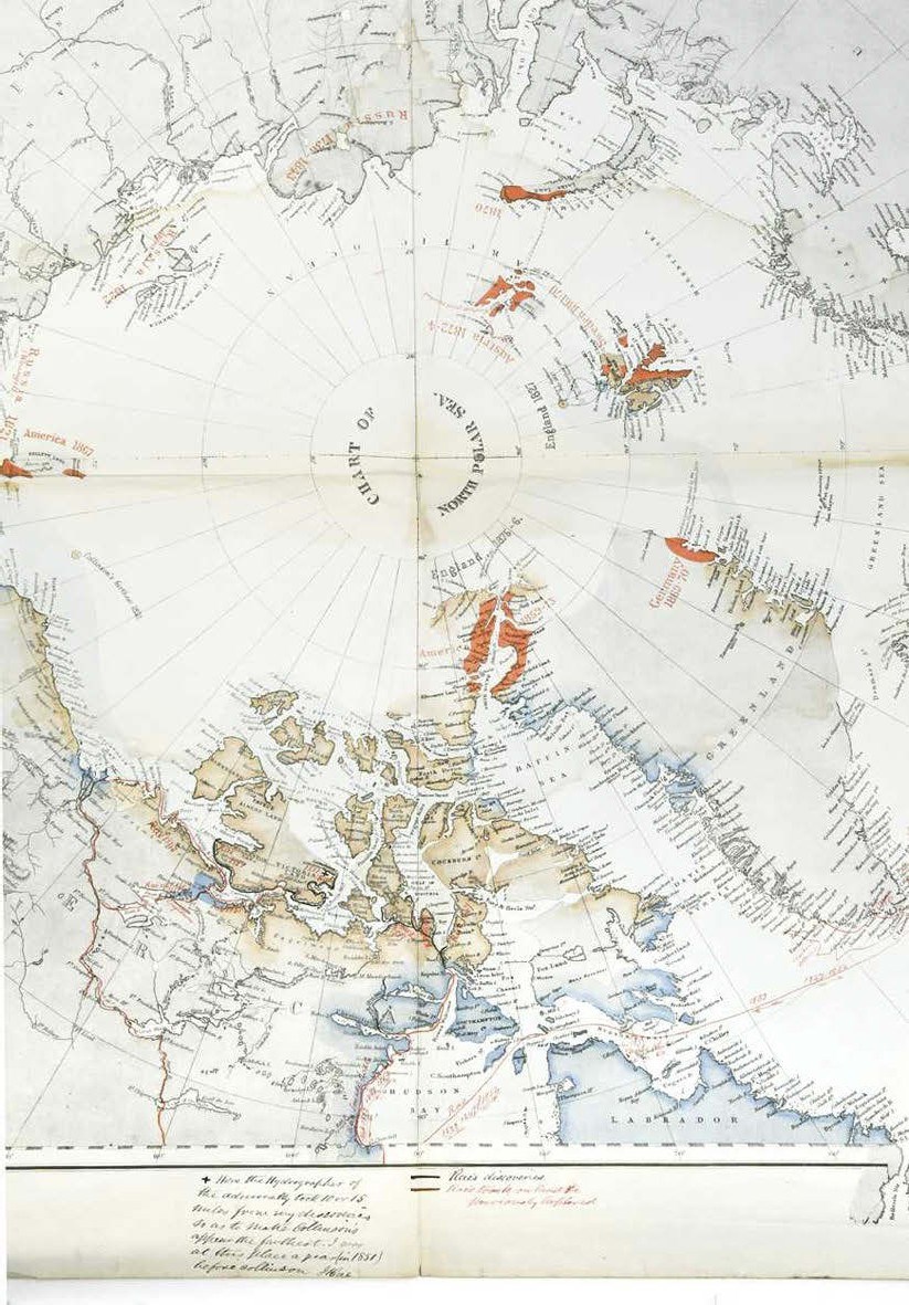
Malby & Sons' Chart of the North Polar Sea annotated by Scottish explorer John Rae, £8000 at Cheffins.
Notes in red and black ink to this Malby & Sons Chart of the North Polar Sea were made by the Scottish explorer and surgeon John Rae (1813-93), the man who discovered the fate of the lost Franklin expedition.
The map came by descent from the family of the Victorian MP Albert Pell (1820-1907). While family records do not tell of a meeting between Pell and Rae, both worked with the Hudson Bay Company in the 1870s.
A detail of the Malby & Sons' Chart of the North Polar Sea annotated by Scottish explorer John Rae, £8000 at Cheffins.
Rae completed four Arctic exploration voyages, mapping much of the coastlines on foot or by boat. The Rae Strait at King William Land is named after him – the final piece of the jigsaw in discovering a North-West Passage. Second in command of Sir John Richardson’s party sent to search for Franklin, he returned with artefacts including a small silver plate engraved Sir John Franklin, KCH and the information that close to 30 corpses had been found. Rae made two reports on his findings: one for the public, which omitted any mention of cannibalism, and another for the Admiralty which included it.
However, the latter was leaked to the press, and caused great outcry in Victorian society, not least with Lady Franklin who refused to accept the news and campaigned against Rae.
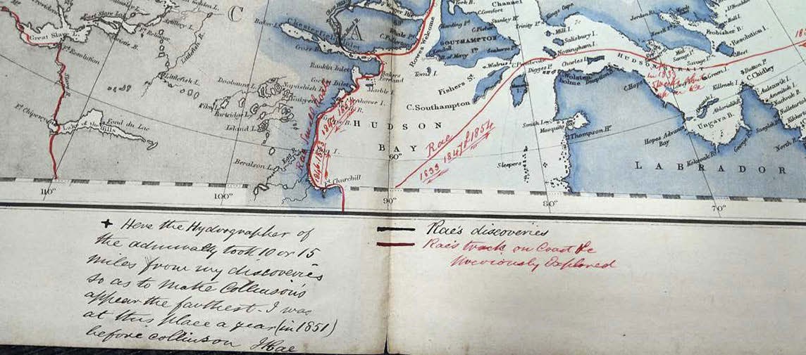
Cheffins’ lithographic map was originally found inserted into an 1848 copy of Keith A Johnson’s The Physical Atlas illustrating the Geographical Distribution of Natural Phaenomena. Rae marks his personal discoveries in black ink with other “track on coast or previously explored” routes marked in red.
He adds a marginal note stating: “Here the hydrographer of the Admiralty took 10 or 15 miles from my discoveries so as to make Collinson’s appear the farthest. I was at this place a year (in 1851) before Collinson. J Rae.”
In the Cambridge sale on April 4 it was estimated at £400-800 but took £8000 from a bidder using the LiveAuctioneers platform. The Victorian atlas in which it was stored was offered separately, selling for £150.