
They were discovered at the Edinburgh New Town home of the late Dr Ann Carswell (1940-2019), an American born in Washington and educated at Cornell and Harvard who lived in Scotland from the late 1960s.
She had been a regular buyer at local salerooms for many years (much of her collection was dispersed via a single-owner sale earlier in the year) but these very rare maps had been found later by a family member shortly before the house was sold.
They were identified by specialist Richard Edwards with the aid of Beatrice Bath, who, before joining Ramsay Cornish, worked for nine years in the books department at Christie’s South Kensington.
‘Most important’ US map
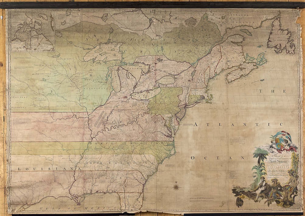
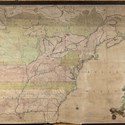
The first was John Mitchell’s (1711-68) Map of the British and French Dominions in North America… which has been called ‘the most important map in American history’.
It was first published ‘by the Author Febry 13th 1755 according to act of Parliament and Sold by And[rew] Millar opposite Katharine Street in the Strand’. Prepared by Mitchell (who was born in Virginia but educated at Edinburgh University) on the eve of the French and Indian War, it assumes a pro-English interpretation of boundaries and borders claiming lands well beyond the Mississippi.
Running to 21 editions and impressions between 1755-81, it would play a significant role in the resolution of territory disputes well into the 19th century. The first two states of the first edition include the town name of Leicester in Massachusetts twice.
This Ramsay Cornish example, estimated at £50,000-70,000, was thought to be the third state with one of the ‘Leicesters’ corrected to Worcester. It was in fragile condition but this is a map that, when better preserved, has sold for over $250,000. It took £105,000 (plus 20% buyer’s premium) from the London trade.
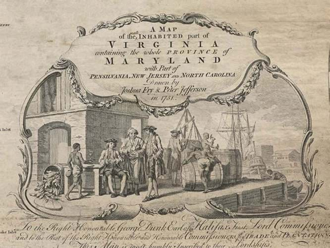
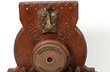
Fry and Jefferson’s 1753 map of Virginia and Maryland includes this image of a tobacco warehouse. To this early printing the word ‘most’ has been added to the title in ink.
Rarer example
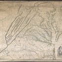
The second map was a yet rarer example titled A Map of the Inhabited Part of Virginia Containing the whole Province of Maryland with Part of Pennsilvania, New Jersey and North Carolina. Drawn by Joshua Fry and Peter Jefferson (father of President Thomas Jefferson) in 1751, it was published in London in 1753 by Thomas Jeffereys, Geographer to His Royal Highness the Prince of Wales at the Corner of St. Martins Lane, Charing Cross.
Again, regarded as the definitive map of Virginia in the 18th century, Mitchell and Lewis Evans (who published his map of the ‘Middle British Colonies’ in 1755) used it as a resource. The cartouche, showing a tobacco warehouse and wharf, is one of the earliest printed images of the Virginia tobacco trade.
The map is known in as many as eight editions but this copy, backed on linen and fixed top and bottom to ebonised batons, is believed to be the rare and virtually unobtainable first state.
It is distinctive from future printings by the lack of the word ‘Most’ in the title. Here the word ‘most’ has been added in ink by a contemporary hand.
Estimated at £30,000-50,000, it sold to a US private collector at £66,000.